| Antique Prints | Autographs | Rare Books | Connecticut | Law |
| Maps | Miscellaneous | Newspapers & Magazines | Historical Memorabilia | Political |
| World War I Posters | World War II Posters |

|
|
|
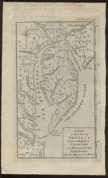
"A Map of that Part of America where a Degree of Latitude was Measured for the Royal Society: By Cha. Mason, & Jere. Dixon"
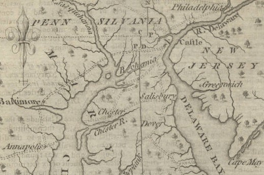
Below is a close-up of the top of the map showing Philadelphia, Baltimore, Annapolis, Dover and Cape May
Date: 1769
Price: SOLD
|