1740
"An Accurate Map of the
West Indies. Exhibiting Not Only All the Islands Possess'd by the
English, French, Spaniards & Dutch, but also All the Towns and
Settlements on the Continent of America Adjacent thereto"
Includes the present United States from Virginia to Florida and West as
far as East Texas and all of the Caribbean and Central America. |
 |
|
1740
"A View
of the Town and Castle of St. Augustine, and the English Camp before it
June 20. 1740. By Thos. Silver" |
  |
|
1740
" A New Map
or Chart of the Western or Atlantic Ocean, with Part of Europe Africa &
America: Shewing the Course of the Galleons, Flota &c. to and from the
West Indies." |
 |
|
1744
Bellin
Map of Northeast America and Canadian Maritime Provinces
Nicely Matted and Framed
|
 |
|
1746
"A New Chart of
the Coast of New England, Nova Scotia New France or Canada, with the
Islands of Newfoundld. Cape Breton St. John's &c. Done from the Original
Publish'd in 1744. At Paris. By Monsr. N. Bellin" |
 |
|
1750
"A Plan of
the Harbour of Chebucto and Town of Halifax"
The famous "porcupine" map |
 |
|
1754
"A Map of the
British American Plantations, Extending from Boston in New England to
Georgia; Including All the Back Settlements in the Respective Provinces,
as Far as the Mississipi"
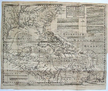
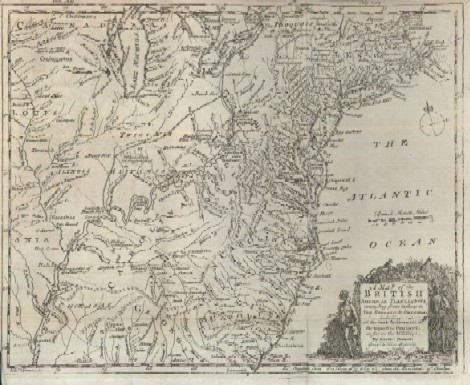
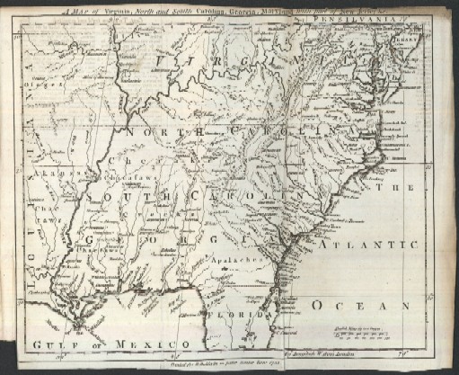
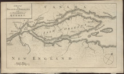
Spectacular map is part of complete 40
page July 1754 issue of Gentleman's Magazine which includes a
very early published account of 23 year old George Washington's first
and second military expeditions leading to French and Indian War.
|
 |
|
1754
"A General
Map of the Discoveries of Admiral de Fonte & Others, by M. De l'Isle"
Map includes Alaska, California and the
fabled Northwest Passage, still believed possible in 1754
|
 |
|
1755
"A Map of
Virginia, North and South Carolina, Georgia, Maryland with part of New
Jersey & c."
This map also includes all or parts of
present day Alabama, Florida, Louisiana, Missouri, Illinois, Indiana,
Ohio and Pennsylvania.
|
 |
|
1757
"A MAP of
that part of AMERICA which was the Principal Seat of War in 1756"
This map pictures all or parts of New York, Vermont, New
Hampshire, Maine, Massachusetts, Pennsylvania and the populated parts of
Canada. |
 |
|
1758
"A Plan of
the City & Harbour of Louisburg; Shewing that Part of Gabarus Bay in
which the English Landed, also their Encampment during the Siege in 1745"
Map pictures Cape Breton Island and
Nova Scotia as well as a close view of Louisburg |
 |
|
1759
"A Map of the
Country between Crown Point and Fort Edward"
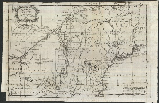
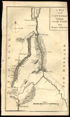
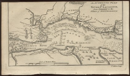
This map pictures the area of New York
and Vermont where Sir William Johnson had his first military victory
during the French and Indian War. The area was later infamous for the
Indian massacre after the British surrender of Fort William Henry.
|
 |
|
1759
"A Map of the
Island of Orleans with the Environs of Quebec" |
 |
|
1759
"An Authentic
Plan of the River St Laurence, from Sillery to the Falls of Montmorency" |
 |
|
1760
"A
Particular Map, to Illustrate Gen. Amhersts, Expedition, to Montreal;
with a Plan of the Town & Draught of ye Island"
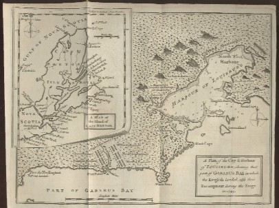
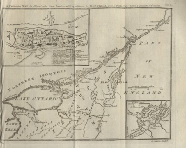
This map is three maps in one and shows
the final battle scenes in the French and Indian War which were fought
in Northern New York and Canada. It has inset maps of the Montreal area
and a Montreal city plan. |
 |