History Gallery

Antique Prints Autographs Rare Books Connecticut Law
Maps Miscellaneous Newspapers & Magazines Historical Memorabilia Political
  World War I Posters   World War II Posters  

HOME       About Us


World Maps

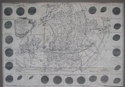
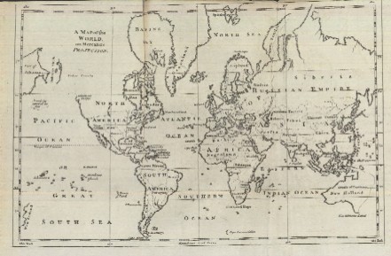
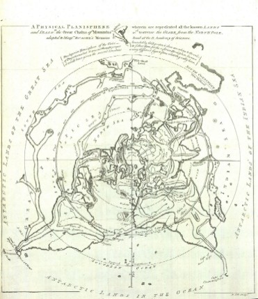
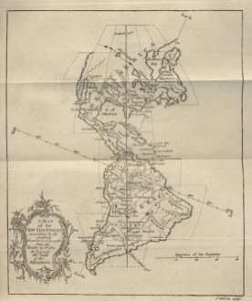
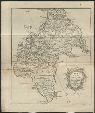
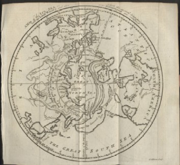
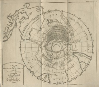
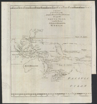
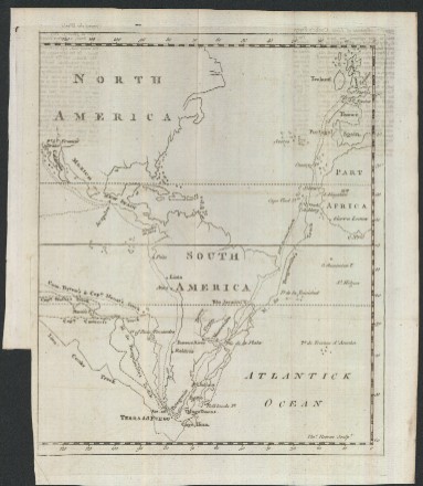
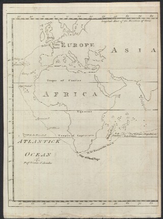
This section includes maps that cover an area larger than one continent that were published in the 1700s. All are copper engravings published by the renowned Gentleman's Monthly. Click on the pictures or titles below to bring up a higher resolution map with more information, price and a PayPal button to purchase the map via credit card or bank transfer.

1748

"The Geography of the Great Solar Eclipse of July, 14. MDCCXLVIII. Exhibiting an Accurate Map of All Parts of the Earth in which it will be Visible with the North Pole According to the Latest Discoveries. By G. Smith Esqr."

1755

"A Map of the World, on Mercators Projection"

1757

"A Physical Planisphere wherein are Represented All the Known Lands and Seas wth. the Great Chains of Mountains wch. Traverse the Globe from the North Pole. Adapted to Monsr: Buache's Memoire Read at the R. Academy of Sciences"

1758

"A Map of the New Continent According to its Greatest Diametrical Length from the River la Plata to beyond the Lake of the Assiniboils"

1758

"Old Map of the Continent according to the greatest diametrical Length from the Point of East Tartary to the Cape of Good Hope"

1760

"A Map of the Icy Sea in which the Several Communications with the Land Waters and other New Discoveries are Exhibited"

1763

"Chart of the Antarctic Polar Circle, with the Countries Adjoining, According to the New Hypothesis of M. Buache. From the Memoirs of the Royal Academy at Paris"


1773

Three (3) Maps of Captain's Cook's Voyage Around the World

Up to Top of Page

Map Index